
How was your weekend? Even though we had rain, it wasn't too bad. and for the most part, on both days the rain held off until the afternoon and evening hours. I actually got a little too much sun yesterday before the rain came in!
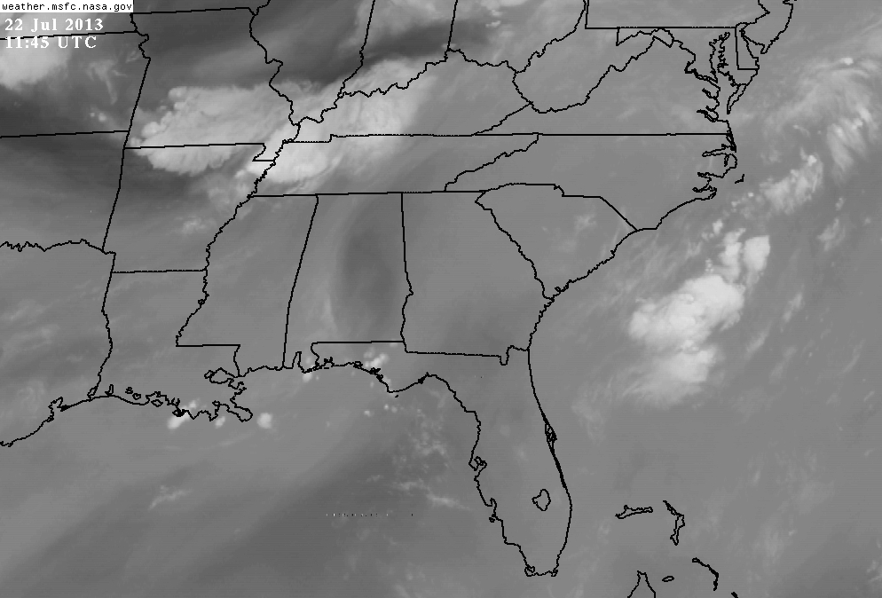
We are beginning a transition to a NW flow aloft, so today there will be widespread synoptic lifting across the SE in response to a digging trough axis, and a very moist (2" PW) and a moderately unstable (1500-2000 CAPE) air mass that will help to create widespread showers and thunderstorms between noon and 9 PM tonight. This next shortwave is evident on radar this morning over MO/AR/TN. Load this page, click on Water Vapor Loop, after it loads click "Speed+" about 8 times. You'll need Java enabled on your browser. This loops come from NASA so they are safe to load. You'll see the upper level low to our north and see how the shortwaves and impulses flow around the low our direction.
Over the next several days, this northwest flow will bring impulses in the divergent flow aloft, that will create mainly diurnal afternoon and evening showers and thunderstorms. These upstream impulses are very hard to forecast and can change on a day to day basis, so the NWS has broad-brushed a chance of rain each day, so ignore the percentages for now.
As we move toward the 2nd half of the work week, expect our rain chances to go down slightly as somewhat dryer air filters in. This will also cause our temperatures to increase to normal or maybe slightly above, but the heat won't last long though as the models are depicting another round of rain for the weekend.
With another 1.06" of rain last night, I'm now over 9.13" for the month and that puts me within 2" of the total rainfall for all of last year. I keep track of the rainfall here at DaculaWeather.com and from the official reporting station for the Atlanta NWS here. You can also view the Precipitation maps here.
I've also added several new pages (like I need any more...!) One page is Georgia River, Lake, and Stream Levels which is updated daily around 9am (graphs updated hourly) another is Storm Prediction Center Mesoscale Discussions, and also NWS Administrative Messages (which most people could care less about).
Please remember, whenever you need weather information, please visit us at the new and improved DaculaWeather.com. You can also get the latest weather information by following us on Twitter, Facebook, and here on the Patch! DaculaWeather.com... Your Window to the Weather