Health & Fitness
Freezing Rain, Sleet Possible Thursday Night
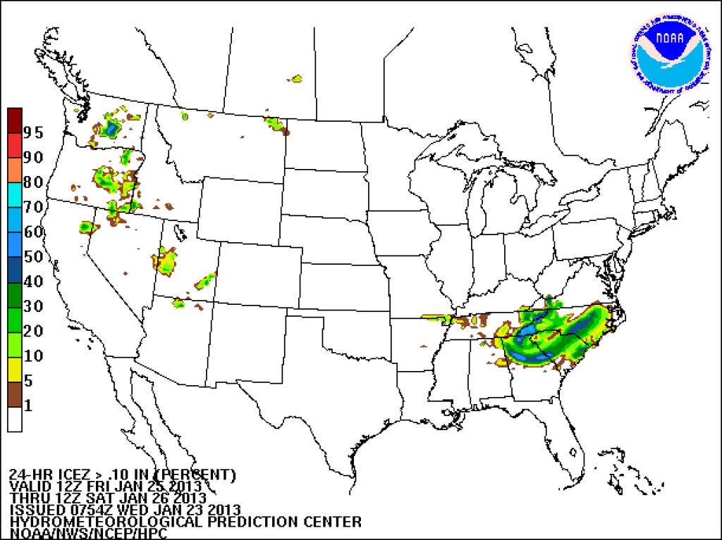
Friday morning could be absolutely treacherous over north Georgia.


Well, well. What a change a day or two makes. Monday the NWS was calling for 56 degrees on Friday. Tuesday, when I mentioned the possibility of ice on Friday, the NWS was calling for 53 degrees. Today they are calling for 36 and I expect that to be lowered even further.
Here's the scenario. A strong arctic high pressure system that has brought bitterly cold temperatures to the north and northeast, will start to slide eastward today. As it does, the clockwise rotation of the air around this high will cause cold air to ride down the east side of the Appalachian mountains (known as Cold Air Damming or CAD). The very cold dense air can't go west so it's forced south down the east side of the mountains.
As this happens, a clipper type of shortwave (a bundle of energy in the atmosphere) comes riding down from the northwest Thursday night. As it does, a warm moist flow in the mid-levels begins to overrun the cold dense air below. If it's above freezing at the mid levels (which it is forecast to be maybe around 40 degrees or so) the precipitation falls as rain. But as it reaches the very cold arctic air at the surface (20s), the rain begins to freeze.
Find out what's happening in Daculawith free, real-time updates from Patch.
Depending on how warm that warm-nose of air is and how thick the cold air is, the precipitation will either fall as freezing rain or sleet for us. It won't be cold enough for snow (at least not right now), so sleet and freezing rain will be our main threat. Models are showing a very cold dense CAD developing, with temps dropping into the 20s Thursday night. Cold rain falling into those temps will cool the surfaces rapidly through evaporative cooling and cause the rain to freeze to anything it touches. I believe Friday morning (assuming the models continue on their present course) will be absolutely treacherous over north Georgia.
Here's another issue. The ground over most parts of north Georgia is very saturated right now. At this time of year, evaporation from the soil is slow at best. What that means is if the trees get enough ice on them, they are more likely to fall due to the wet, loose soil.
Find out what's happening in Daculawith free, real-time updates from Patch.
This could be one of the worse ice storms we've had in many years. I will be making updates here when I have new updates. I am expecting watches and warnings to begin to go up within the next six hours.
Much more to come...
Please remember, whenever you need weather information, please visit us at the new and improved DaculaWeather.com. You can also get the latest weather information by following us on Twitter and Facebook DaculaWeather.com... Your Window to the Weather