Health & Fitness
Slight Risk for Severe Weather Tonight
Approaching front brings more chances for rain and severe weather.
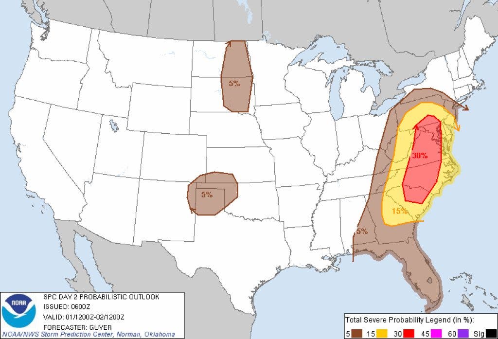


The Storm Prediction Center has outlined our area as being at a slight risk for severe weather late tonight and into Friday ahead of an advancing cold front. Right now the severe weather parameters are marginal and it appears the greatest threat will be from wind and possibly hail.
There is currently a vortex max with isolated thundershowers over Alabama which might reach western Georgia this morning and our area later this afternoon. Clouds are already overspreading the area which will hopefully keep the temperatures in check today.
Cooler temperatures will move in behind the front with highs Saturday only approaching 80 degrees with a few degrees warmer for Sunday. It should be a great weekend for getting outdoors.
Find out what's happening in Daculawith free, real-time updates from Patch.
Whenever you need weather information, please visit us at the new and improved DaculaWeather.com. You can also get the latest weather information by following us on Twitter and Facebook DaculaWeather.com... Your Window to the Weather