September continues the above normal temperature trends as the 16th consecutive month with above-average temperatures for the Lower 48.
Here are a few highlights:
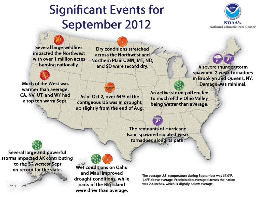
- The warm and dry conditions across the Northwest were associated with another month of above-average wildfire activity. Nationally, nearly 1.1 million acres burned during September, the 3rd most on record for the month.
- According to the October 2, 2012 U.S. Drought Monitor, 64.6 percent of the contiguous U.S. was experiencing moderate-to-exceptional drought, slightly larger than the extent of drought at the end of August.
- The January-September period was the warmest first nine months of any year on record for the contiguous United States. The national temperature of 59.8°F was 3.8°F above the 20th century average, and 1.2°F above the previous record warm January-September of 2006. During the nine-month period, 46 states had temperatures among their ten warmest, with 25 states being record warm. Only Washington had statewide temperatures near average for the period.
- For the second straight month, mean temperatures were near normal across much of the Southeast region.
You can read the entire Sate of The Climate report here at DaculaWeather.com
Find out what's happening in Daculawith free, real-time updates from Patch.
Please remember, whenever you need weather information, please visit us at the new and improved DaculaWeather.com. You can also get the latest weather information by following us on Twitter and Facebook DaculaWeather.com... Your Window to the Weather
We’ve removed the ability to reply as we work to make improvements. Learn more here