Health & Fitness
Transitioning From Fall to Winter
It's that time of the year when the weather can flip on a dime, warm one day and very cold the next.

Just a quick look back at November. We ended the month with temperatures that were pretty close to normal, here are November averages going back to 2008:
- 2011 - 52.2
- 2010 - 51.1
- 2009 - 52.3
- 2008 - 49.9
November 2011 Summary:
Find out what's happening in Daculawith free, real-time updates from Patch.
- High: 78.0
- Avg High: 65.1
- Avg: 52.2
- Avg Low: 40.9
- Low: 25.4
- Rain: 3.79"
- Days with rain: 10
Time to look ahead at the upcoming week and beyond.
Find out what's happening in Daculawith free, real-time updates from Patch.
Short Term - An elongated area of low pressure stretches from the Gulf to the Ohio Valley region and is bringing an enhanced area of rain and snow to the central part of the country, with some areas getting as much as 6" of rain. This area will slowly progress east toward Georgia over the next several days. As it gets closer, showers will break out ahead of the front. Rain should hold off until Monday but we could see some drizzle today as we have a moist upslope easterly flow from the Atlantic. Areas to our west will get the heaviest rainfall with this system but it weakens and the energy moves to our north as it gets closer, so we might only see an inch of rain before it exits the state.
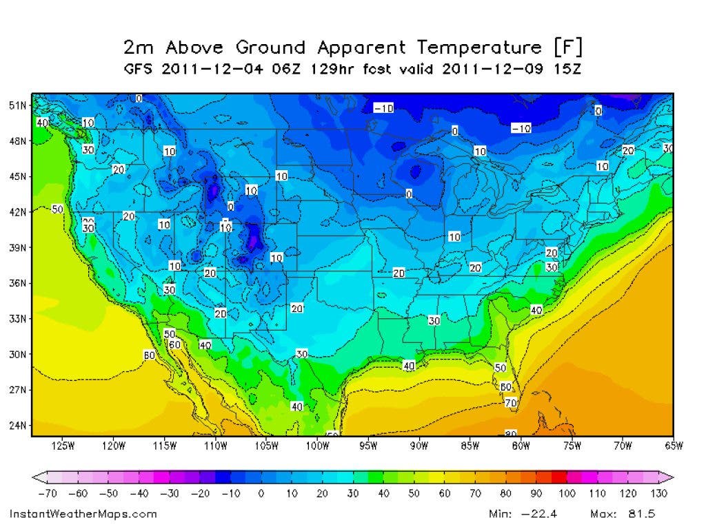
Long Term - Cooler air starts to enter Georgia behind the front, but there are some interesting changes taking place in the atmosphere. There are indications that a piece of the Polar Vortex will be moving over Hudson Bay which means we'll be getting shots of very cold air dropping south over the next several weeks. Couple that with a very active amplified flow with a raging southern jet stream, and you have all the ingredients for a winter type event. It's still looking like there is a threat of a major winter storm around the December 11-16th time frame... stay tuned!
Models are showing a deep blast of cold air possibly arriving this weekend (see maps) so that is also something we're watching right now. It's that time of the year when the weather can flip on a dime, warm one day and very cold the next. There will be days where we warm up in between the cold shots, but I believe it's going to be a very active and exciting few weeks for weather.
Please remember, whenever you need weather information, please visit us at DaculaWeather.com. You can also get the latest weather information by following us on Twitter and Facebook
DaculaWeather.com... Your Window to the Weather