Health & Fitness
Will More Severe Weather Lead to a Pattern Change?
It's possible that the models are picking up on a pattern change that might bring us more winter-like conditions.
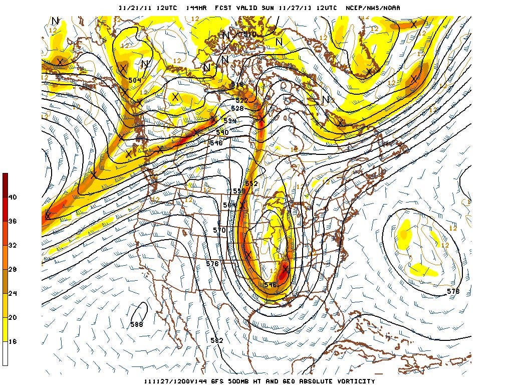


The GFS is showing a very large storm around the 27th of this month (Sunday, see map). Along with this large system, it's possible that the models are picking up on a pattern change that might bring us more winter-like conditions as we head into December and the start of meteorological winter. I've included some discussions about this system from my meteorologist friend Robert Gamble, you can follow Robert's blog here.
"What's more, the strong winds. This could end up being a dangerous low level wind field event complete with a well developed low level jet. We've had a few of those before and the GFS has a slug of 850 winds developing on the east side of the strongly developing 5h cutoff (in western TN at 140 hrs). That would place GA in a dangerous spot, with 925mb winds that are 55knts if I recall, the whole 850 wind field is tight but oriented strong north to south as it crosses the Apps. The lower level 925 winds are strong starting in GA and working to western Carolinas by 144 to 150 hours aimed right at north GA , western Carolinas...so tha'ts quite a wind event, even without convection. I've seen high wind events play out like this, and almost always the deeper the 5h low to our west in TN, and in a very longitudinal flow (north-south). It can come preceding a squall line or after a squall line. Definitely a fascinating system to watch. Let's see if the ECMWF joins it later. But for now its having good ensemble support.
It's looking really quick again at this run, it brings the high winds across Carolinas and stretches northwest to Michigan. Blocking surface high in Eastern Canada, and the placement of everything on this run screams severe, then heavy rains (upslope strongly in ne Ga, se facing apps), then high wind event. I couldn't have drawn it better. If the GFS verifies exactly like that, its going to do some damage in several ways.
GFS uses this storm to change the pattern. It's so massive it has a huge influence on the flow. Brings down colder air, but not terribly cold ...but its a definitely flow changer. Incredibly cold air is developed in central to north Canada, in fact the coldest in the hemisphere is on our side. And the GFS has atleast a weak PNA and some ridging in northern Greenland. Don't know if any of its right, esp. farther out, but I'm seeing wintry precip threats in December somewhere pretty far south once we get this behometh over with (assuming this large cutoff comes to pass)....no shortage of s/w in the flow...supressed flow could be coming (sort of split in the flow) Still a little antsy on it, but I do lean more GFS than ECMWF lately."
We will definitely keep an eye on this system and will provide more details once we get closer to the event.