

Here's a new page for Karen information:
http://www.daculaweather.com/4_karen.php
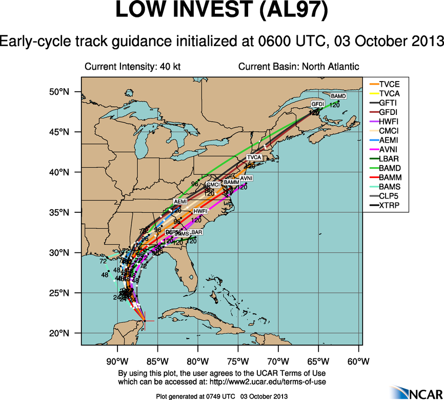
Right now it appears that Karen will make landfall as a minimal hurricane.
Latest Update:
BULLETIN
TROPICAL STORM KAREN INTERMEDIATE ADVISORY NUMBER 2A NWS NATIONAL HURRICANE CENTER MIAMI FL
AL122013 100 PM CDT THU OCT 03 2013
..KAREN EXPECTED TO APPROACH THE NORTHERN GULF COAST ON SATURDAY...
SUMMARY OF 100 PM CDT...1800 UTC...
INFORMATION ----------------------------------------------
LOCATION...22.9N 88.2W ABOUT 430 MI...695 KM S OF THE MOUTH OF THE MISSISSIPPI RIVER
MAXIMUM SUSTAINED WINDS...65 MPH...100 KM/H
PRESENT MOVEMENT...NNW OR 330 DEGREES AT 12 MPH...19 KM/H
MINIMUM CENTRAL PRESSURE...1004 MB...29.65 INCHES
WATCHES AND WARNINGS --------------------
CHANGES WITH THIS ADVISORY... NONE.
SUMMARY OF WATCHES AND WARNINGS IN EFFECT...
A HURRICANE WATCH IS IN EFFECT FOR... * GRAND ISLE LOUISIANA TO INDIAN PASS FLORIDA A TROPICAL STORM WATCH IS IN EFFECT FOR... * WEST OF GRAND ISLE TO EAST OF MORGAN CITY LOUISIANA * METROPOLITAN NEW ORLEANS * LAKE MAUREPAS * LAKE PONTCHARTRAIN
Like what you read here and want to be notified of new posts and updates? You can subscribe to this weather blog by clicking here and then clicking on "Get email updates"Please remember, whenever you need weather information, please visit us at the new and improved DaculaWeather.com. You can also get the latest weather information by following us on Twitter, Facebook, and here on the Patch! DaculaWeather.com... Your Window to the Weather