


After a few weeks of tranquil weather, there appears to be a change on the way.
For the last several days the computer models have been showing a tropical system (possibly Karen?) forming in the Gulf of Mexico and moving into the southeast. To make matters worse, a cold front with a possible cut-off upper level low will be moving out of the plains toward the southeast at roughly the same time. The combination of the two systems could bring some serious rainfall over our area by the weekend. Speaking of tropical systems, this was the first time since 1994 that we haven't had a Cat 2 hurricane through September.
Right now the WPC's QPF map places Georgia in a +2" range over the next 7 days, but that amount will be dependent on the eventual track, intensity, and timing of the future Gulf system.
See images above or click on these links:
Track Forecast
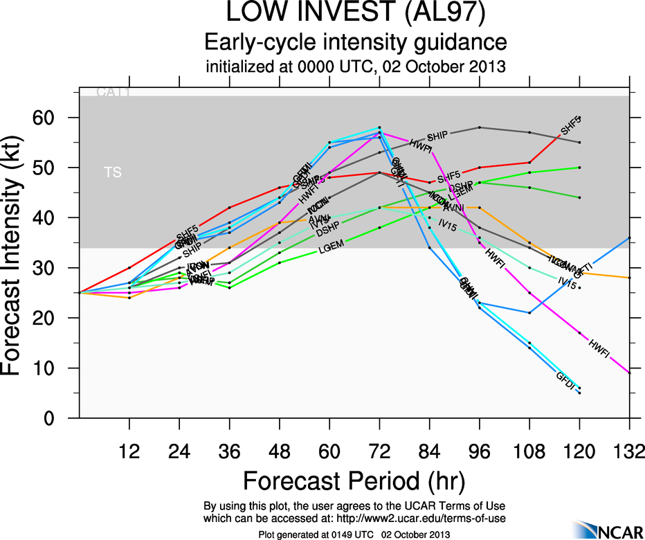
Intensity Forecast
7 Day QPF
This from the NHC on what is now called Invest AL97:
SHOWER AND THUNDERSTORM ACTIVITY ASSOCIATED WITH AN ELONGATED AREA OF LOW PRESSURE OVER THE NORTHWESTERN CARIBBEAN SEA REMAINS DISORGANIZED. SOME DEVELOPMENT OF THIS DISTURBANCE IS POSSIBLE DURING THE NEXT COUPLE OF DAYS... AND THIS SYSTEM HAS A MEDIUM CHANCE... 30 PERCENT... OF BECOMING A TROPICAL CYCLONE DURING THE NEXT 48 HOURS WHILE IT MOVES NEAR OR OVER THE NORTHEASTERN PORTION OF THE YUCATAN PENINSULA LATE WEDNESDAY AND INTO THE SOUTHERN GULF OF MEXICO WEDNESDAY NIGHT OR THURSDAY. UPPER-LEVEL WINDS ARE EXPECTED TO BE MARGINALLY CONDUCIVE FOR DEVELOPMENT WHILE THE DISTURBANCE MOVES GENERALLY NORTHWARD OVER THE GULF OF MEXICO LATE THIS WEEK. THIS SYSTEM HAS A MEDIUM CHANCE... 50 PERCENT... OF BECOMING A TROPICAL CYCLONE DURING THE NEXT 5 DAYS. LOCALLY HEAVY RAINS COULD AFFECT THE CAYMAN ISLANDS AND PORTIONS OF CUBA DURING THE NEXT DAY OR TWO.
I'll make another update as we get closer to the weekend, but I wouldn't make big outdoor plans if you haven't already!
Like what you read here and want to be notified of new posts and updates? You can subscribe to this weather blog by clicking here and then clicking on "Get email updates"Please remember, whenever you need weather information, please visit us at the new and improved DaculaWeather.com. You can also get the latest weather information by following us on Twitter, Facebook, and here on the Patch! DaculaWeather.com... Your Window to the Weather