Health & Fitness
TS Dorian - Potential Southeast Rain Maker?
Will Dorian have any effect on our weather?

As if we haven't had enough rain, we now have to look toward next week as Tropical Storm Dorian makes it's way across the Atlantic toward the southeast US. (Dorian page)
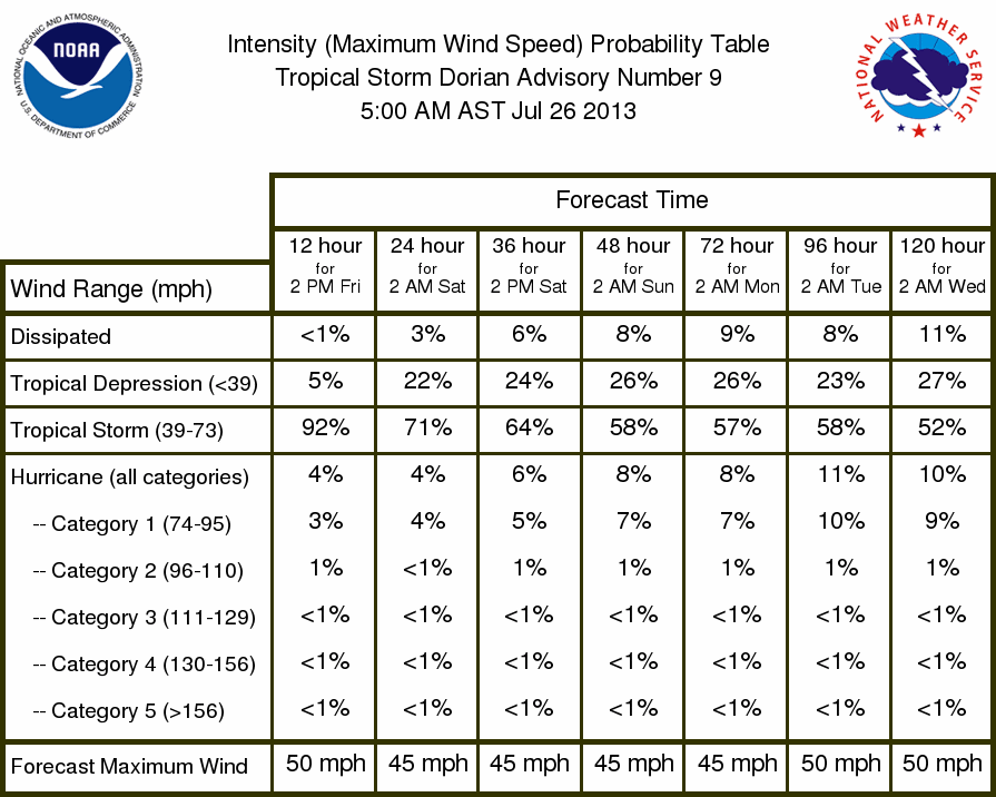
The National Hurricane Center is now issuing advisories on Dorian, and as of this morning, Dorian was located out in the middle of nowhere in the Atlantic and is moving WNW at about 20 mph. Maximum sustained winds are currently around 50 mph and extend about 60 miles out from the center.
Dorian has weakened overnight and appears a little disorganized right now, and for the next several days Dorian will not be in a favorable environment for strengthening. You can see the unfavorable shear conditions that Dorian will be entering from these shear maps. Sea surface temperatures are great, but without upper air support, strengthening will be slow to occur, if it occurs at all.
The current 5 day forecast track (see image above) brings Dorian toward Florida by Wednesday of next week. A few models take her toward the Bahamas while others take her toward the Florida peninsula. Plenty of time for all of this to change, so we'll keep an eye on Dorian's progression as she quickly takes aim toward the southeast. You can keep track of Dorian as she approaches the US from this page.
Please remember, whenever you need weather information, please visit us at the new and improved DaculaWeather.com. You can also get the latest weather information by following us on Twitter, Facebook, and here on the Patch! DaculaWeather.com... Your Window to the Weather